
Pick a flower, stir the stars. But will it rain at home?
Why is it so hard to forecast rain for one orchard or village? And why might better forecasts still fail the people who need them? On weather science, local names for wind, and letting those who live with the consequences set the questions.
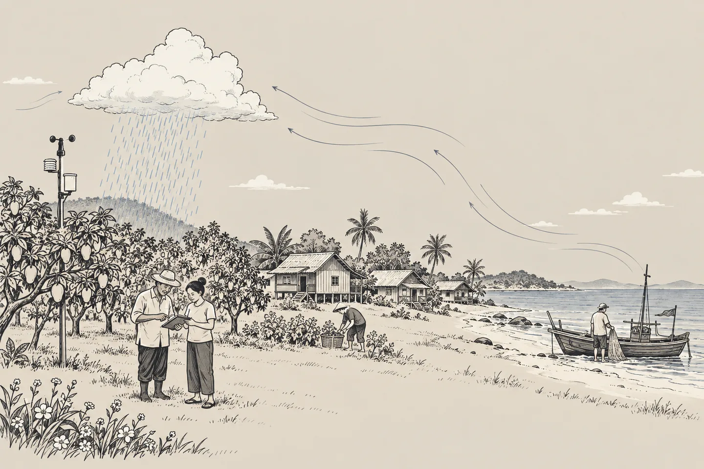
Next door, someone is rushing to bring in the washing. At our house, the sun is still out. Anyone who has watched rain falling at the end of their street will know the frustration of opening a forecast and finding the same cloud-and-raindrop symbol for the entire district. All we want to know is whether it will rain where we are, and when.
That short question is very hard for a weather forecaster to answer. But for someone about to take a boat out, hire people to harvest fruit, or lay produce out to dry, it needs an answer before they get to work. They cannot simply wait until we are certain. By then, some decisions will already be too late.
When we try to solve this problem, we often think of more weather stations, finer models, or more powerful computers. I see their value too. But I have another question: suppose our forecasts become more accurate. What more do the people living under that sky gain? Do they find out in time, understand what they are being told, and have more options available to them?
In When we step back, who carries on?, I asked how early local people should have ownership of decisions. Weather brings us back to the same question. Do we begin with the data we have, or with the lives people have to live, then work out together what else we need to know?
What does a flower have to do with rain?
“Pick a flower, stir the stars” is an image of how a small action might have consequences much further away than we imagine. In meteorology, a related idea is sensitivity to initial conditions, often known through the phrase “butterfly effect.” Edward Lorenz's work showed that a system following the same set of equations can reach very different outcomes if its starting conditions differ even slightly.1
I am using the flower as a way into the question. It does not mean we can pick a flower and make a storm happen wherever we choose. The atmosphere still follows the laws of physics. We simply cannot measure temperature, humidity, pressure and wind perfectly at every location and height, all at the same moment.
Before calculating the future, we therefore need to estimate what the atmosphere is like now. Meteorologists combine observations with the previous round of short-range model forecasts, adjusting the estimate while accounting for errors in both the instruments and the model. This process is called data assimilation.2
Equations then calculate how wind, heat and moisture will change. The difficulty is that some small errors can grow as the calculation progresses. The further ahead we ask, and the finer the detail we want, the more carefully we need to consider whether our answer reaches beyond what we actually know.
We need to distinguish what better observations, tools and calculations can improve from the limits of predictability in a particular situation. Uncertainty is real. It should not become a reason to stop improving the work.
Knowing rain is coming is not the same as knowing where it will fall
Picture a hot, humid afternoon. Air near the ground begins to rise. The trigger might be a warm surface, a sea breeze meeting another flow of air, or hills forcing the air upwards. As the rising air cools enough for water vapour to condense, a cloud begins to appear. Whether it grows into a thunderstorm also depends on the atmosphere above it. Some days, a layer of air suppresses that upward movement. Even plenty of heat and moisture below may not be enough.3
Once a storm cloud forms, it changes its surroundings. Evaporating rain cools the air, and cool air descending with the downdraught spreads out along the ground. Its leading edge may lift warm, moist air nearby and help another cloud form. We are watching clouds develop, grow, fade and trigger one another, rather than simply watching the same cloud drift across the sky.4
A model may get the broad situation right: there is plenty of moisture today, and conditions favour thunderstorms. It can still be wrong about where air first starts to rise, or how early or late that happens. The European Centre for Medium-Range Weather Forecasts, or ECMWF, explains this distinction clearly: conditions favourable for storms can be forecast further ahead than the precise location and timing of rain from individual groups of clouds.5
For someone looking at a map of the whole region, the rain may have arrived close to where it was expected. For people on opposite sides of the rain's edge, that error may be the difference between getting their goods under cover in time and losing what they left out to dry. We use the same word, “accurate,” while judging answers over different areas and periods of time.
This does not mean every local forecast is unusable. Forecasting the afternoon temperature and the location of a newly forming thunderstorm present different difficulties. A day of widespread, sustained rain from a large weather system has different uncertainties from a day of scattered showers. We need to ask: accurate about what, how far ahead, and checked against what?
Zooming in on a map does not give us equally detailed knowledge
Models divide the atmosphere into computational cells, horizontally and vertically. Mountains, coastlines, clouds and exchanges of heat at scales too small for the model to describe must be simplified or have their effects approximated. Smaller cells can resolve more detail, but they still need good starting data and good ways of representing those processes.6
A pin in an app may sit exactly on our house. The number beside it may come from a grid cell larger than the whole orchard, or from an estimate between grid points. Even if local statistics have been used to adjust it, we still need to check how well that works. The same applies to minute-by-minute displays. We can make a screen show numbers at shorter intervals. Whether the forecast becomes more accurate is another question.
That is why local observations matter. Within DO IN THAI's work, ARMOGAN addresses weather stations and the use of local data alongside larger models. But adding stations also means looking after data quality. Where is a station installed? Is anything blocking the wind? Is the rain gauge clogged? Do the timestamps agree? Who will notice when an instrument fails? We also need to explain how far a reading at one point can represent the surrounding area.
As an event gets closer, radar, satellite images and the latest observations help us follow changes. This approach to forecasting the immediate future is called nowcasting. It is very useful for tracking rain, but projecting an existing area of rain forwards begins to fail when it grows, fades or is joined by newly forming rain along the way.7
Another approach is to run many forecasts, varying the starting conditions and parts of the model within the uncertainties we have. This is called an ensemble. It helps us see how the possible futures spread out. Agreement between many runs may give us more confidence. But if they share a weakness, they can still all be wrong in the same direction. The probabilities they produce therefore need to be checked continually against what actually happens.8
People need both the forecast and a clear account of what remains uncertain. We might be fairly confident that rain could develop in this area this afternoon, for example, while its position and timing may shift. When will fresh information be available? People making decisions need to know what to check again, instead of seeing a rain symbol once and being left to carry the remaining risk themselves.
Accurate for whom?
Before discussing accuracy, we need to agree on what the words mean. “Rain over 60% of the area,” which describes the distribution of rain, is different from “a 60% chance of rain at this point during this period.” The number is the same. The first statement concerns a proportion of an area. The second concerns the probability of an event that must be defined: how much rain, where, and when?9
For a well-calibrated probability forecast, if we collect enough cases assigned a 60% chance, the event as defined should occur in roughly six out of ten of them. One dry day is not enough to show that the probability was wrong. But the opposite caution matters too: probabilities that look reliable overall may not work equally well in every location or season.10
Even when people understand the information in the same way, they use it differently. Imagine two people seeing the same chance of rain. One has a few pieces of washing beside a window. The other needs hired labour to bring in produce spread across a drying yard. Bringing everything in when it does not rain carries different costs. Leaving it out when rain does arrive causes different losses. There is no single percentage at which we can decide, on everyone's behalf, what they must do.
In practice, people may need more than an answer about whether it will rain. Will the dry spell last long enough to finish the job? Will gusts arrive ahead of the rain? When might rain in the hills affect the route home? That last question also needs information about the catchment and its waterways. A rainfall forecast alone cannot answer all of it.
This is why impact-based forecasting, promoted by the World Meteorological Organization, or WMO, pays attention to what weather will do to people and to what is present in an area. Hazard information needs to be considered alongside who is there, what could be damaged, and how well people can cope.11 For me, doing this well means letting the people who use the information help frame the questions. A modeller cannot know the details of every occupation and every life on their behalf.
Whose eyes do we see through, and whose shoes do we stand in?
We often talk about putting ourselves in someone else's place. Sometimes, though, we still look through our own eyes and assume they must see what we see. Someone with a car outside their house and someone waiting for the only boat of the day will read “possible rain this evening” very differently. To walk in their shoes, we need to know where the route home runs, who needs picking up, and what happens if they miss that boat.
An orchard grower may be thinking about fruit ready to harvest. A market seller may be thinking about today's income. Someone caring for an older person may be thinking about how long it will take to get them out of the house. Even within the same subdistrict, people's fears and the lead time they need will differ. We should not reduce a “user” to someone who owns a phone and knows how to open a notification.
Feelings have their reasons too. Someone who once stopped working because of a warning and lost income may hesitate next time. Someone whose house has flooded may become anxious as soon as the sky darkens. Calling one person unaware and the other too easily alarmed can stop us seeing the experience they are bringing to their decisions.
Some people understand a warning perfectly well and still cannot act on it. They have no vehicle, nobody to take over caring responsibilities, or not enough money to stop working. Clearer wording helps with part of the problem. The rest requires people and resources that make action possible. If someone knows everything they need to know but still cannot go anywhere, can we count the communication as a success?
Winds had names before we had apps
Knowledge of weather did not arrive in communities with the first monitoring station. People whose livelihoods depend on water, wind and the seasons already had ways of observing differences and words for describing them. Listening to the names of different winds can tell us about the landscape, the time of year and the work people do.
A study by Chaturong Kongkaew and colleagues in four coastal communities in Ko Muk Bay, Trang, recorded names including “ลมพลัด” for a westerly wind, “ลมหัวนอน” for a southerly wind, and “ตีเหมาปาดัง” for a northeasterly wind. These names also appeared in participants' accounts of the seasons, sea conditions and fishing.12
What interests me is that people naming winds are distinguishing things that matter in their lives. If we record only that one word equals one direction, then turn it into degrees in a database, we may lose something important. When does this wind arrive? How long does it last? What tells people it is here, and how do they change their work when they notice it? One name should leave us with much more to listen to.
We need to hear from people who use that language in that place. A name from one community should not stand in for an entire region. Even within a community, people of different ages and occupations may explain it differently. Those differences deserve to be recorded and understood, rather than hurried into a standard term that puts everyone in the same box.
The same study also recorded participants finding parts of their existing knowledge harder to apply as environmental and weather conditions changed, and turning to forecasts as another source of information. This is a finding from the communities studied. It does not prove that local knowledge everywhere has stopped working, or that every change has the same cause.12
Preserving local knowledge should therefore include preserving people's ability to observe, question and adapt. If we keep only their old answers and insist that they follow them forever, we risk freezing living knowledge at the moment we happened to interview them.
Bring the knowledge into conversation, then try it together
I would begin with a small group: people who use the information, people who know the area, and people who can explain the science. Then I would choose one real decision to work on together. How much warning does someone drying produce need to bring it in on time, for example? That gives us a starting point other than deciding how many devices to install and finding people to use them afterwards.
There are examples of working with holders of local knowledge that we can learn from. UNESCO LINKS supports community members in doing research and exchanging knowledge with scientists, while paying attention to the rights of those who hold that knowledge.13 Thinking about our own work, I see several things we would need to keep doing together.
Record a word along with the situation in which it is used. Let people explain their knowledge in their own language. Record their voices, draw where they stood to observe, and note the date, time and what they noticed. Ask what they expected to happen, within what period, and what they decided to do. Agree beforehand on what can be made public, who will look after the records, and how people can return to revise their own explanations.
Measure things that can fairly be compared. To investigate whether a wind observation is associated with rain, record occasions when the sign appears and rain follows, when it appears and no rain follows, and when rain comes without the sign. Write it down before the outcome is known, instead of remembering only the matches. Check the timing, location and quality of instrument readings too. Comparing different places or periods and declaring one side wrong would hardly be fair.
Test what it adds to what we already know. Does the observation give more warning than the forecast people already use? Does it work only at the start of the season? If we use it to develop a forecasting rule, the period used to find the relationship must be kept separate from the period used to test it on new observations. Otherwise, we may end up with a rule that explains the past well but fails when the next season arrives.
When accounts disagree, we should not immediately average them into apparent agreement. Wind measured by a station above open ground and wind felt behind a line of trees may be describing conditions at different locations. Some observations may still lack sufficient evidence, or may no longer hold. We should be able to say so without devaluing the person sharing them. People in the community should also be able to question how trustworthy our instruments are.
Let people help design the messages and the options for action. Take the same set of information and discuss what each person understands: what will happen, where, when, what remains uncertain, and what they can prepare now. If local canal or hill names, or a voice message in the local dialect, help people understand, use them. Keep the source, issue time and limitations available so the information can be checked. The wording can be shorter without losing essential meaning.
After trying it, return to ask whether the message arrived in time, whether people understood what the sender intended, who did not receive it, and what prevented those who did from acting. Assess both forecast quality and its usefulness for decisions. Some knowledge may not make rainfall predictions more precise, but may help identify who needs warning first or how much time to allow for moving goods. That has value too.
This work needs money to maintain instruments, time for people to coordinate it, and payment for those helping to record knowledge. Calling it community participation while leaving people to do extra work without support would be unfair. Especially if their data leaves the area to become part of our work, while the people who helped collect it cannot even access it themselves.
How much can a government see from the centre?
My criticism of the Thai state is that too much of both the thinking and the authority to decide still sits at the centre. When we start with what an agency intends to produce, what travels outwards is a report, a system, or a standard message. Only then do we ask how to make people aware of it. We should also ask, from the beginning, what decisions different groups need to make and what say they have in shaping the service.
If local areas can only send data upwards and pass messages on, but cannot specify when they need information, propose changes to a warning, or access funds to address the problems they find, a station in every province will not be enough to make the service start with local people. Data can become more detailed every year while the relationship between those who decide and those who live with the consequences stays the same.
The value of central provision is clear. Observation networks, radar, large forecasting models and data standards need resources and continuity that individual communities would struggle to provide. Central agencies have an essential role in making this information reliable and accessible. But the ability to calculate the big picture does not also give them knowledge of life in every place.
I would like central agencies to take responsibility for data quality and explain uncertainty clearly, while local authorities and the people using the service have the authority, funding and support to shape communication and responses for their area. Roles and ways of coordinating need to be agreed. Feedback from local people must be able to change the service, including correcting things the centre has misunderstood.
The state needs to know more than how many devices successfully received a message. What did people understand when they read it? Did they get their goods under cover in time? When they were told to leave, did they have somewhere to go? Who will reach those outside the LINE group? The same warning arriving after someone has taken their boat out and arriving before they decide whether to leave can have very different value.
That is why I think even more accurate forecasts may still fail to reach people's lives if the way we work does not understand the eyes they see through and the shoes they walk in every day. Saying that the public needs to learn more may be partly right. The agencies responsible for communicating must also be willing to learn much more about the people they serve.
References
-
MIT News (2008). Edward Lorenz, father of chaos theory and butterfly effect. Background to the idea of sensitivity to initial conditions.
-
ECMWF. Data assimilation. Estimating the atmosphere's initial state using observations and model information, including the uncertainty that remains.
-
NOAA National Weather Service. Thunderstorm Ingredients. Moisture, atmospheric stability, lifting mechanisms and layers that suppress storm development.
-
NOAA NESDIS. What Is a Gust Front? and NOAA NSSL. Addition to weather model helps forecast precip types more accurately. Evaporative cooling, cool air spreading out from a storm, and gust fronts that can trigger new storms.
-
Magnusson, Tsonevsky and Hewson (2018), ECMWF. Forecasting convective rain events in late May. The distinction between forecasting an environment favourable for storms and the location and timing of individual areas of rain.
-
ECMWF (2017). How to pin down uncertainty in weather forecasting. Uncertainty arising from how physical processes are represented and from model limitations.
-
Met Office. Nowcasting and How to use our 10-day weather forecasts. Forecasting the immediate future, including assumptions involved in tracking rainfall movement.
-
Met Office. Ensemble forecasting. Multiple forecast runs to assess uncertainty in initial conditions and models.
-
Thai Meteorological Department. Weather criteria (in Thai). Rainfall distribution is expressed as a proportion of an area and must be distinguished from probability at a particular point over a particular period.
-
Johnson and colleagues (2019). SEAS5: the new ECMWF seasonal forecast system. Section 3.1 explains how reliability is assessed by comparing forecast probabilities with observed frequencies. This essay draws only on that principle, not on seasonal forecast performance as a measure of local rainfall forecast skill.
-
WMO (2021). Impact-based forecasting informs anticipatory action. Using impact information alongside hazard information to support preparation and early action.
-
Chaturong Kongkaew, Jawanit Kittitornkool and Kongkiat Kittiwatanawong (2017). Climate change and changes in local fishing knowledge: a case study of four coastal villages in Ko Muk Bay, Trang (in Thai; title translated here). Journal of Environmental Management 13(2), 4–17. Wind names and descriptions appear on page 10 and record the knowledge of participants in the study communities. 2
-
UNESCO LINKS. Knowing our Changing Climate in Africa. Examples of community research, exchanges with scientists, and the rights of knowledge holders. The working practices proposed in this essay develop these ideas in the context of community work.